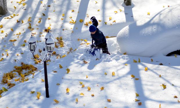
Massive Snowstorm Hits Buffalo Area
Wednesday, November 19, 2014
Play
00:00 / 00:00
 Drew Ahmed makes his way through nearly five feet of snow on Nov. 19, 2014 in Buffalo, New York.
(John Normile/Getty Images)
Residents in Buffalo are beginning to dig themselves out of
record-breaking snow. Parts of Western New York town were pummeled
yesterday with as much as six feet Tuesday. And forecasters say more
snow is coming.
The storm is an example of lake effect snow, said Patrick Burke, a meteorologist with the National Weather Service. He explained that typically, convection draws moisture into the lower atmosphere as cold air moves across a relatively warmer lake, and winds carry the system ashore. This time the air was especially cold, Lake Erie is warmer than it would be later in the year, and the winds stretched the length of the 240-mile-long lake in the right direction, making for an even stronger snow dump that hit land and persisted for an unusually long period, about 30 hours.
"In this case, all of those factors have been maximized," Burke said.
Lake effect snow can even be viewed from from space.
Because streets are clogged with snow and abandoned vehicles, local officials are instructing residents to shelter in place. Seven deaths have been blamed on the snow.
The storm is an example of lake effect snow, said Patrick Burke, a meteorologist with the National Weather Service. He explained that typically, convection draws moisture into the lower atmosphere as cold air moves across a relatively warmer lake, and winds carry the system ashore. This time the air was especially cold, Lake Erie is warmer than it would be later in the year, and the winds stretched the length of the 240-mile-long lake in the right direction, making for an even stronger snow dump that hit land and persisted for an unusually long period, about 30 hours.
"In this case, all of those factors have been maximized," Burke said.
Lake effect snow can even be viewed from from space.
#LakeEffect bands from above. Visible satellite loop 7:30 AM to 9:15 AM EST 11/18/2014. #snow #nywx http://t.co/Z0XWoOmu9U
— NWS Binghamton (@NWSBinghamton) November 18, 2014
Gov. Andrew Cuomo declared a state of emergency and called the
National Guard in to help clean up. Dozens of people have been stranded
in their vehicles for hours, including the Niagara University women’s
basketball team, which was stuck on the New York Thruway for nearly 30
hours.Niagara University Women's Basketball Team Rescued After Being Stranded for 24 Hours http://t.co/iqUcGqNCZw @ABC pic.twitter.com/Kt2AdSEOw7
— Newsradio KXLY (@kxly920) November 19, 2014
Because streets are clogged with snow and abandoned vehicles, local officials are instructing residents to shelter in place. Seven deaths have been blamed on the snow.
Buffalo, NY was hit by snow so intense it looked like a wall, leaving up to 60 inches (1.5 meters). #BuffaloSnow pic.twitter.com/MoKsOg18PI
— JRehling (@JRehling) November 19, 2014
@WNYweather In Blasdell. pic.twitter.com/THVQWyXYxV
— Christian Steiner (@csteiner1230) November 18, 2014
With the Associated Press.
No comments:
Post a Comment
Please leave a comment-- or suggestions, particularly of topics and places you'd like to see covered